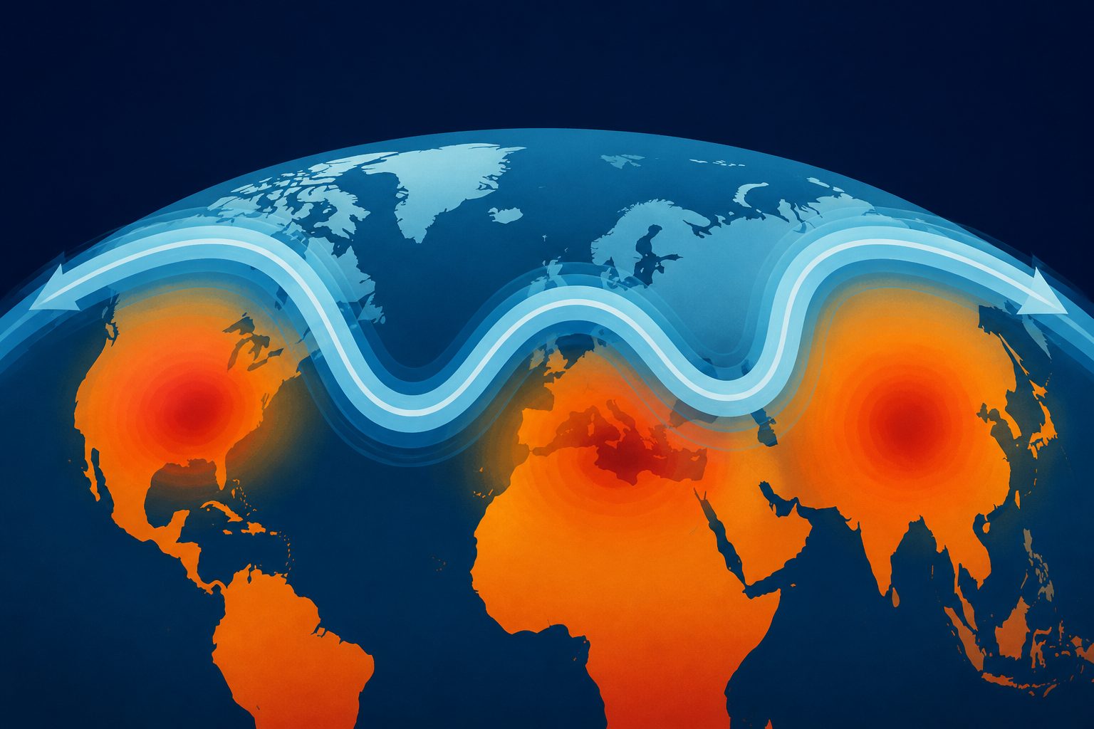
Longer-lasting two-part jet stream patterns were more often accompanied by heatwaves in several regions at once.
Researchers examined split, or “double,” jet stream patterns in a historical reconstruction of weather and in simulations from a climate model. They also used a rare-event method to generate better statistics for unusually long-lasting summer patterns.
The most extreme double-jet states featured three centers of unusually high surface temperatures and high pressure-like height patterns, along with a strong low-pressure area over the Arctic. Heatwaves often occurred near these centers, and their co-occurrence increased with the duration of the double-jet state.
The split-jet pattern
Extreme double-jet states were marked by three centers of unusually high surface temperature and atmospheric height, together with strong low pressure over the Arctic. The atmospheric pattern was consistent with two patterns described in earlier research: a positive Northern Annular Mode and a pattern with three broad waves around the Northern Hemisphere.
Heatwaves frequently occurred at the three centers during these states. The share of double-jet events accompanied by heatwaves increased as the double-jet pattern lasted longer. The abstract does not provide a numerical percentage or establish that the pattern directly causes the heatwaves.
Evidence and caveats
The study combines ERA5, a historical reconstruction of weather, with stationary simulations from the CESM1.2 climate model. Additional simulations used a rare-event algorithm to improve the statistics of unusually long-lasting summer double-jet states.
These results come from an observational reconstruction and model experiments rather than a direct test of cause and effect. The abstract says the atmospheric pattern is consistent with other known circulation patterns, but the mechanisms connecting them to extreme heatwaves remain unresolved. The abstract also gives no numerical estimate of the heatwave increase or of how well the model matches reality.
// Source
Journal of Climate · 2026 · DOI: 10.1175/jcli-d-25-0454.1
Authors: Valeria Mascolo, Francesco Ragone, Nili Harnik, Freddy Bouchet
Institutions: Centre National de la Recherche Scientifique, University of Reading, Tel Aviv University, École Normale Supérieure de Lyon, National Centre for Atmospheric Science, École Normale Supérieure - PSL, University of Leicester, Laboratoire de Météorologie Dynamique, Laboratoire de Physique de l'ENS de Lyon